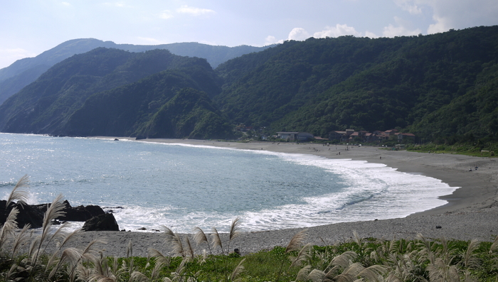
Nanfangao is the largest isthmus along Taiwan’s western coastline. It is connected to Su-ao Harbor, with natural geographical layouts. The Black Tide that flows pass Nanfangao’s outer seas provides an abundance of migrating fish, forming natural fish grounds. The shoreline scenery of the Nanfangao region includes capes, reefs, cliffs, caves, isthmus, bays, and shores.
The coastline along Nanfangao is classified as an erosion coast, so the appearance of a sandbanks is irregular. However, a small island acted as a barrier in the region, causing a sandbank to form from the large amounts of sand that settled behind the island. The sand dune connected with the mainland, forming an isthmus. From the mountains the isthmus is seen as a series of small dunes lying horizontally across the sea, with heights reaching no more than 100 meters. Saddle landforms are obvious, especially between the three dunes to the right, which together form the shape of a pen holder. Hence, the locals call this area “Pen Holder Mountain”.